 Skip to main content

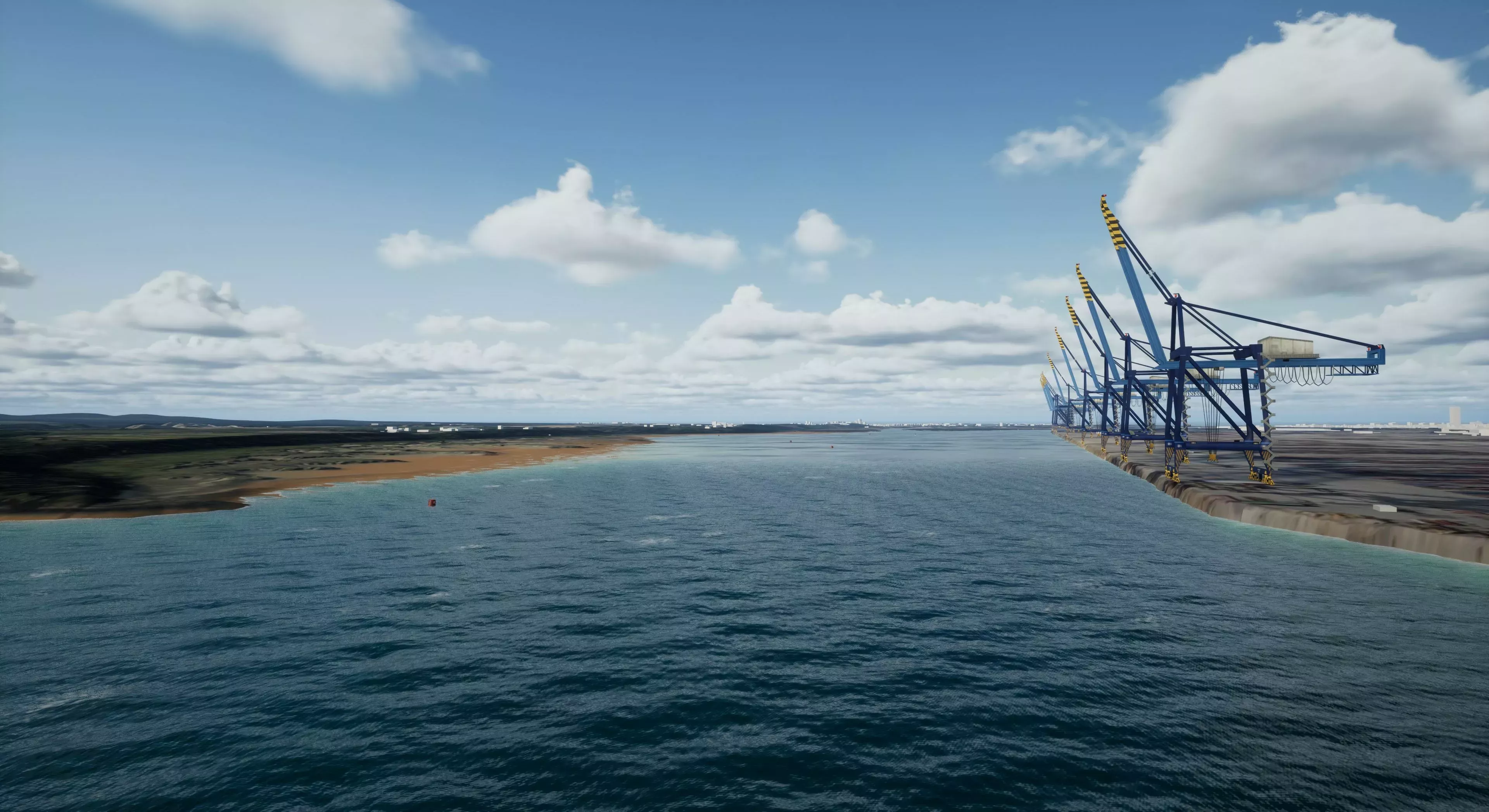
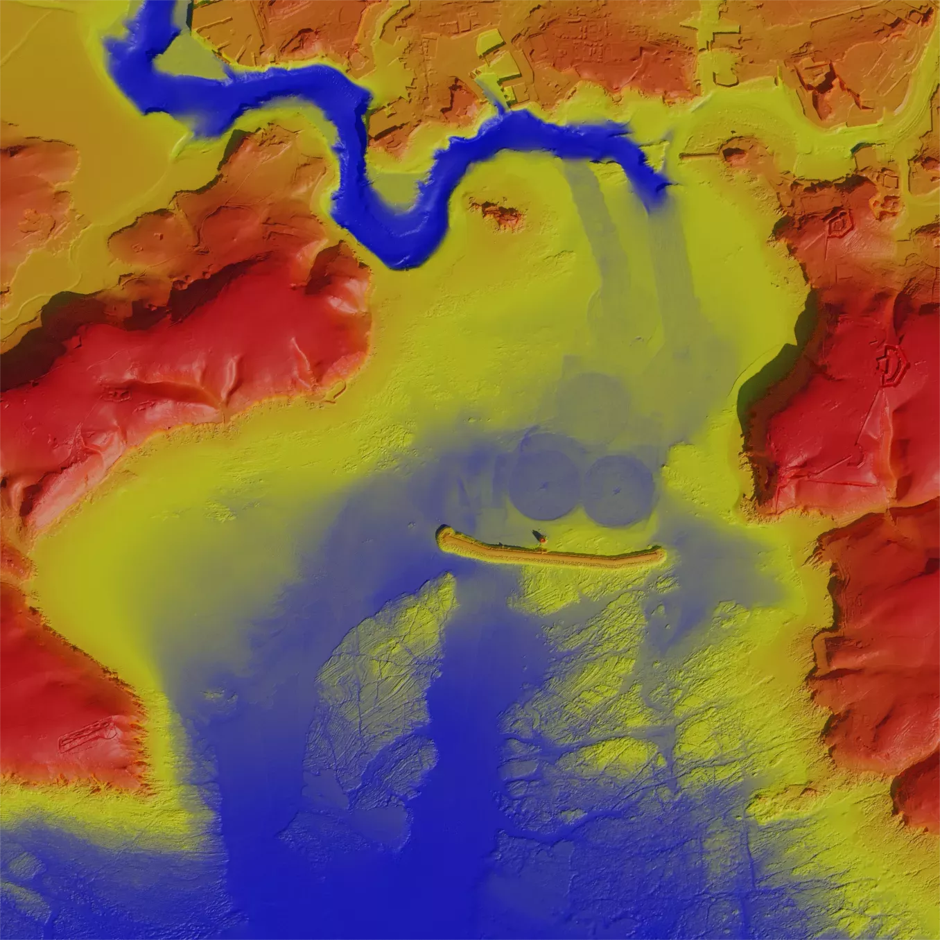
Digital twins for port familiarisation
Experience an immersive visualisation of a port entry and exit scenario with our new digital twin concept.
Using cutting edge gaming engine technology, combined with official ADMIRALTY data and dynamic environmental data feeds, the tool provides a 4D visualisation of the port environment in varying conditions.
By providing a realistic depiction of port entry and exit customised to your vessel, this technology enables mariners to familiarise themselves and rehearse navigational scenarios in varying conditions.
Watch our video to find out more about the benefits of digital twins, or ask one of our staff members to experience the technology for yourself.
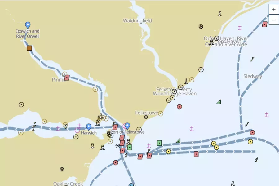
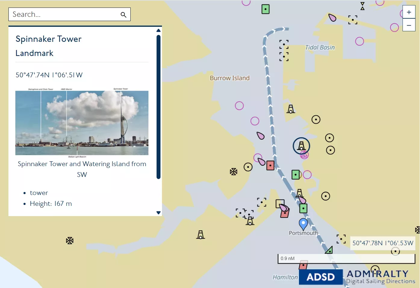
ADMIRALTY Digital Sailing Directions
ADMIRALTY Digital Sailing Directions (ADSD) offers essential information to support port entry and coastal navigation - now in a new, easy-to-use digital format.
This new generation of Sailing Directions provides the same trusted planning information in a new and improved digital format, helping you to create effective passage plans for safe, efficient and compliant voyages.
Find out more about ADSD by scrolling the features below, or ask one of our staff members for a live demonstration today.
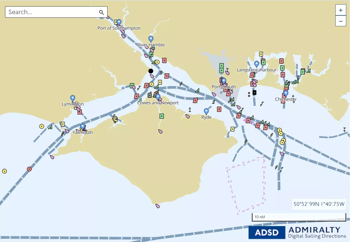
Clearly visualise key features
The new geo-display makes it easy for navigators to visualise the position of features relevant to their route, providing enhanced spatial awareness of critical navigational information and helping to reduce the workload of navigating officers.
This includes clear geo-referenced features and an intuitive user interface that makes it easier than ever to find the information you need.

Designed for navigators
ADSD has been developed with the mariner in mind.
By working closely with navigating officers around the world, we have developed a product that aims to reduce the time spent planning a passage while improving route safety and efficiency.
Access the same trusted information
ADSD offers the same high-quality information produced by the UK Hydrographic Office as found in traditional Sailing Direction - but in a more accessible and user-friendly format.
Therefore mariners can be confident they are using the same trusted data that they have valued and relied upon for decades.

Find out more
Find out more about ADMIRALTY Digital Sailing Directions by scanning the QR code:

Discover our ADMIRALTY portfolio
Click below to find out more about our world-leading range of ADMIRALTY products and services.
ADMIRALTY shore-based web services
The ADMIRALTY shore-based web service provides a range of Application Programming Interfaces (APIs) that enable users to display Electronic Navigational Charts (ENCs) and maritime features data online.
These APIs provide access to the complete range of ADMIRALTY ENCs and maritime feature data sets to inform maritime decision making and enable users to provide shore-based support to their fleets. This data is updated by the UK Hydrographic Office (UKHO), so users have the latest information via the API to inform their planning decisions.

ADMIRALTY Vector Chart Service
The ADMIRALTY Vector Chart Service (AVCS) is the world’s leading official digital maritime chart service, with around 18,000 official Electronic Navigational Charts (ENCs) to help bridge crews navigate safely and efficiently whilst meeting flag and port State requirements.
ADMIRALTY Digital Publications
ADMIRALTY Digital Publications (ADP) are computer-based applications of the UKHO’s market-leading paper-based nautical reference guides, including:
• ADMIRALTY TotalTide - Accurate tidal predictions for 7,000 ports and 3,000 tidal streams worldwide.
• ADMIRALTY Digital List of Lights - Official light and fog signal information for 90,000 light structures.
• ADMIRALTY Digital Radio Signals - Official maritime radio communications information worldwide.
ADMIRALTY e-Nautical Publications
ADMIRALTY e-Nautical Publications (AENPs) are official ADMIRALTY Nautical Publications available as e-books, bringing improved efficiency, accuracy and access to information bridge officers need.
90 official ADMIRALTY Nautical Publications are available including Ocean Passages for the World, the Nautical Almanac, the Mariner’s Handbook and many more.
ADMIRALTY shore-based web services
The ADMIRALTY shore-based web service provides a range of Application Programming Interfaces (APIs) that enable users to display Electronic Navigational Charts (ENCs) and maritime features data online.
These APIs provide access to the complete range of ADMIRALTY ENCs and maritime feature data sets to inform maritime decision making and enable users to provide shore-based support to their fleets. This data is updated by the UK Hydrographic Office (UKHO), so users have the latest information via the API to inform their planning decisions.
ADMIRALTY Vector Chart Service Online
ADMIRALTY Vector Chart Service (AVCS) Online is a shore-based version of the world's leading maritime chart service that is used on board most ships trading internationally. With access to images of over 18,000 ENCs available at all scales, AVCS Online supports shore-based maritime decision making such as vessel tracking, voyage planning, and accident and emergency incidents.
The next generation of data standards
With more data being collected and shared across the maritime industry than ever before, having a common set of standards is key to making this data accessible, compatible and valuable for all users.
The S-100 data framework will provide a universal standard that will underpin the future navigational technologies with more powerful maritime information - from high density gridded bathymetry to dynamic tidal data. The UKHO are at the forefront of developing S-100 solutions by developing and testing new data sets and conducting real-world sea trials.
Watch our video to explore the latest standards or speak to one of our experts today on how S-100 will enable future navigational solutions.