 Skip to main content

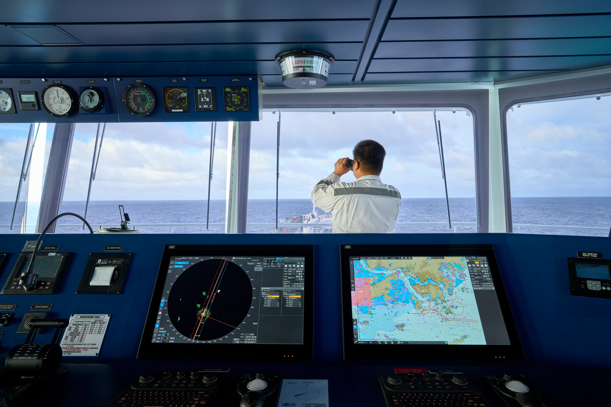
What is S-101?
As part of the International Hydrographic Organization’s (IHO) new S-100 data framework, S-101 is the new standard being introduced for Electronic Navigational Charts (ENCs).
S-101 will be the product specification that defines how hydrographic offices construct and distribute ENCs for display in ECDIS, replacing the current standard, S-57, and will be fully interoperable with a wide range of other hydrographic and marine data sets as part of the wider S-100 ecosystem.
Why introduce a new standard for ENCs?
 First developed back in 1992, S-57 was hugely successful in standardising how hydrographic data is created and shared.
With the turn of the century, the industry saw the widespread adoption of digital navigation, including the mandatory carriage of ECDIS for all large vessels enforced by 2016. Today, ENCs are the primary choice for navigation for the global fleet. It is thanks to S-57 that over 50,000 vessels sailing internationally can rely on ENCs from over 100 different producers to be delivered in a common format – enabling seamless display on over 50 different ECDIS models.
But navigation technology has developed significantly in recent years and is being further enabled by remarkable advances in maritime connectivity. As hydrographic offices seek to develop new data products, S-57 lacks the flexibility to truly accommodate mariners’ evolving needs.
So, by building on the success of its predecessor, S-100 is now being introduced as a universal data framework. For the first time, this framework will not only accommodate ENCs, but also a range of other marine data formats including bathymetry, water levels, surface currents, and more.
How will S-101 ENCs differ to existing ENCs?
S-101 will be the base layer for other interoperable data sets and will be much more flexible in accommodating a wide range of much richer information. While many aspects of the ENC will remain the same, there will be some key differences in the portrayal of navigational data – all developed with the mariner in mind.
Familiar look and feel
S-101 ENCs will actually retain the same familiar look and feel as the S-57 ENCs that mariners have come to rely upon. This is intentional; ENC producers understand that familiarity is key to situational awareness and navigational safety on the bridge. Therefore, when introducing a new generation of S-101 ENCs, the portrayal of information has been designed to be as clear and intuitive as possible.
Some subtle improvements have been made based on mariner feedback, which are explored in detail below.
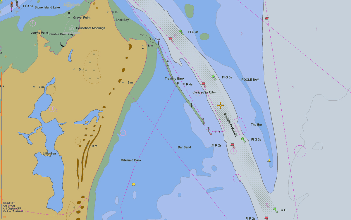
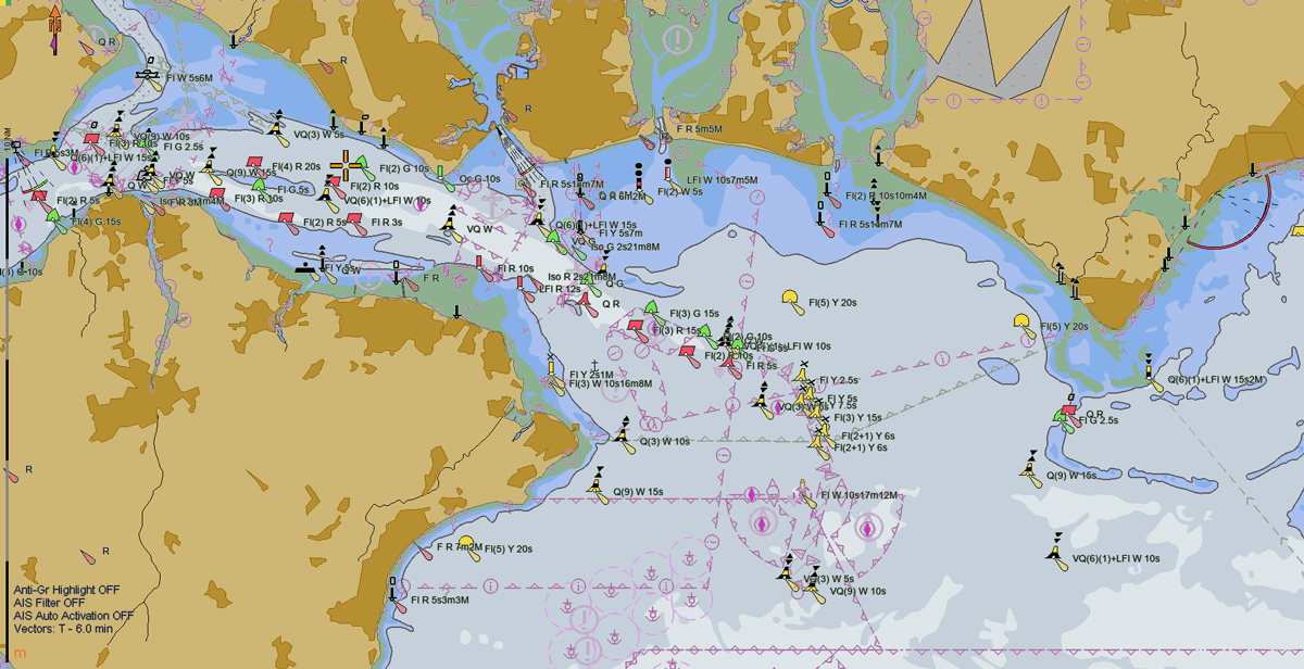
Example of an S-101 ENC (Credit: OSI)
Intelligent text placement
When navigating using ECDIS, clarity and confidence is key. However, often ECDIS users have to turn off textual information on an ENC in order to reduce clutter on screen, which can detract from important navigational information. Similarly, text can often become overlaid and difficult to read.
In S-101 ENCs, intelligent text placement will be introduced, allowing for text to be positioned in a clearer, more user-friendly way. Subtle improvements to the direction of text (e.g. along channels), deconflicting overlaid text, and positioning text more clearly around land boundaries will enable mariners to keep textual information turned on. This will result in less clutter on screen and greater clarity on the bridge.
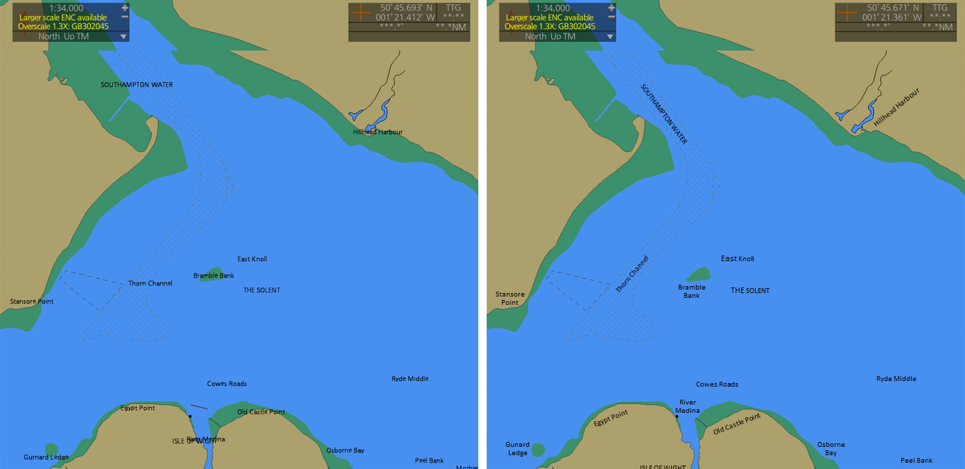
Text placement on an S-57 ENC compared to an S-101 ENC
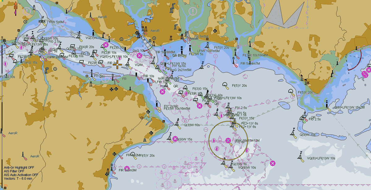
Improved buoyage symbology
Another visual improvement being introduced with S-101 ENCs is the display of buoyage.
Currently, the symbols for buoys on ENCs lack the helpful colour coding that can be found on paper charts. Based on mariner feedback, the buoyage symbology in S-101 ENCs has been redesigned to allow for colour coding to help improve situational awareness. This means if the mariner looks out the window at a cardinal buoy with yellow and black markings, the symbol on the ENC will display the same colours for additional clarity.
Current buoy symbology as displayed on an ENC:
Colour buoy symbology in an S-101 ENC:
(Credit: OSI)
Reduced alarm fatigue
Another issue raised by mariners that is being addressed with S-101 ENCs is the problem of alarm fatigue. Often mariners have to deal with false or unnecessary alarms or warnings when planning and monitoring routes, which can become distracting and increase stress on the bridge – which can pose a risk to navigational safety.
To mitigate this, the IHO have reviewed the set features that would traditionally raise alarms of warnings within an ECDIS system, such as caution areas or obstructions. S-101 ENCs will be encoded more intelligently with new ‘information objects’, which contain metadata about the ENC – which essentially gives ENCs producers more flexibility to encode features into an ENC in a way which doesn’t trigger unnecessary alarms and indications for the user.
Improved cyber resilience
Cyber security is undoubtably an increasing point of concern for mariners in today’s increasingly digital world. With improved encryption and a more robust security scheme, S-101 ENCs – and S-100 data as a whole – will be more resilient to modern cyber threats.
As S-100 data is produced, new security schemes will mean that it will have to be digitally authenticated at every stage of the data pipeline – from when it leaves the hydrographic office, all the way to a vessels’ ECDIS. This provides extra assurance of the security and integrity of the data being used to navigate.
Future-proof for autonomous vessels
 Current ENCs have been optimised for human interpretation; they are specifically designed for use by a skilled mariner in conjunction with other complementary navigational information. However, with the introduction of automated and autonomous technologies, S-100 data needs to be compatible and operational for vessels navigating without a full crew on board.
As such, S-100 data (including S-101 ENCs) will be fully machine readable and futureproof for the requirements of Maritime Autonomous Surface Ships (MASS), and the UKHO are currently leading a working group with other IHO members to fully understand and accommodate the evolving requirements for MASS technologies.
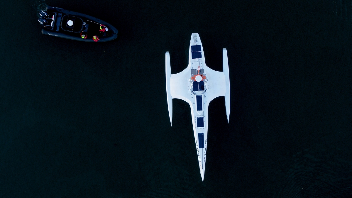
Image credit: Oliver Dickinson for ProMare IBM
What does this mean for shipping companies?
Below are some of the frequently asked questions and key considerations from users, as posed at our recent panel discussions.
How will this impact data sizes?
Thanks to advances in Low Earth Orbit (LEO) satellite infrastructure, recent years have seen a significant improvement in maritime connectivity, which has enabled much more efficient and affordable data transfer from ship to shore – which we expect will continue to improve as the S-100 standards are made available over the coming years.
Currently the maximum file size for an S-57 ENC cell is capped at 5MB. For S-100 data, this cap will be increased to 10MB to allow for richer data to be delivered to the mariner where beneficial, including other products within the S-100 ecosystem such as S-102 bathymetry surface data. This does not mean all S-101 ENCs will be closer to 10MB in size, but it does provide a limit to the maximum file size that can be created by a hydrographic office.
The actual data sizes will depend entirely on the requirements of the navigator. For example, richer data will be able to be delivered for navigationally complex areas such as port approaches, where mariners would benefit from high resolution data to enhance navigational safety and precision. However that granularity of information will not necessarily be required for ENC cells far out at sea.
How will this impact requirements for crew training?
 In order to be used safely and effectively, it will undoubtedly be important for crews to be trained and familiarised in the use of S-100 data.
In recognition of this, international committees are currently looking into the training requirements for S-100. Any updates to seafarer training will be agreed and shared ahead of the implementation of S-100 data, so that mariners can confidently realise the benefits S-100 has to offer.
When will mariners be able to use S-101 ENCs?
The International Maritime Organization’s (IMO) new performance standard will allow shipping companies to fit S-100-enabled ECDIS from 2026. We are continuing to work closely with ECDIS manufacturers and other hydrographic offices to develop, test and trial S-100 data in line with the development of new S-100-enabled ECDIS models. This does not mean S-57 data will become obsolete from 2026; new S-100-enabled ECDIS will also support the display of S-57 data alongside the new S-100 products.
From 2029, all new ECDIS installed should conform with the S-100 performance standard and the IMO will retire the current performance standard (S-57). In practical terms, this means that any new ECDIS fitted on board (including retrofits) will have to be S-100 compatible from 2029.

Name
Thomas Mellor
As Head of Technical Partnerships, Tom leads the UKHO’s collaboration with technical partners including Original Equipment Manufacturers (OEMs) to enable the development of e-navigation products and S-100 solutions for Electronic Chart and Information Display Systems (ECDIS).
Tom works at the forefront of the latest ‘next generation’ navigation technologies to support the implementation of new standards that can help improve safety, efficiency and optimisation.
Learn more about S-100
Discover how the S-100 data standards could transform decision making from ship to shore.
S-100: Shaping the future of navigation
Discover how the next generation of data standards will transform the way decisions are made from ship to shore.
Subscribe to keep updated on S-100
Subscribe to keep updated on the latest developments of S-100 data standards and how these are shaping the future of navigation.