Mark Casey, Katrina Kemp, Dan Hook and Alisdair Pettigrew discuss how marine data can support autonomous shipping.
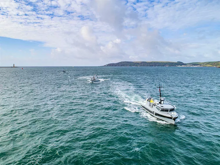
Navigation has made significant advances over the last few decades and shipping now stands on the cusp of the next step in its digital journey: autonomous vessels.
In fact, by 2030, we estimate this sector will be worth a staggering £111 billion and employ over 554,000 people.
Blue data is central to its development and will enable the safe and efficient navigation of tomorrow’s autonomous vessels.
In this panel, Mark Casey, Katrina Kemp, Dan Hook and Alisdair Pettigrew discuss how the geospatial community can support this journey and unlock the potential of unmanned commercial vessels, including:
- What key benefits can autonomous vessels bring to shipping and the wider blue economy?
- What data can support the safe and efficient navigation of autonomous vessels?
- How could we make this data more interoperable for autonomous vessels?
- How will autonomous ships sit within the regulatory framework?

Setting the foundations for autonomous shipping
Autonomous ships have the potential to transform the maritime industry. But how can such vessels navigate safely without a full crew on board?
To help meet this challenge, we have been working with a range of partners to support vital testing and research across the sector; this includes collaboration with the Maritime & Coastguard Agency (MCA) to support the development of new regulations and work with Thales to understand how unmanned vessels could support military operations.
These projects build on ground-breaking research conducted for the Department of Transport in 2018, where we helped to scope future data requirements for autonomous shipping; this included the concept of a ‘smart chart’ system - combining data such as radio signals, regulations, tides and bathymetry into a machine-readable format.
As we move closer to realising the opportunities of autonomous shipping, we will continue to support these new data requirements and emerging standards to enable the safe navigation of tomorrow’s autonomous vessels.

Supporting innovation
In 2020, we launched the ADMIRALTY Marine Innovation Programme to give innovators and start-ups a chance to develop new solutions that could solve some of the world’s most pressing challenges regarding our oceans.
The programme’s first innovation challenge challenged participants to identify how marine geospatial data could support the safe navigation of commercial autonomous ships.
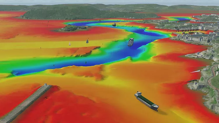
The winning solution, developed by BMT, used simulation technologies and ADMIRALTY data to enhance autonomous operations planning and real-time navigation safety in busy waterways and ports.
The system successfully simulated the navigation of a 140m part-autonomous ferry in Plymouth port using multiple data sets, including bathymetry, tidal streams and heights, seabed composition and ship routing.
Following this success, we are now working alongside BMT to develop an alpha product for the autonomous shipping sector.

Name
Mark Casey
Mark is responsible for identifying and developing new solutions that use marine geospatial data to support commercial shipping and the wider blue economy.

Name
Dr Katrina Kemp
Katrina leads the MCA’s regulatory response to autonomous shipping. She represents the UK at the IMO’s Maritime Autonomous Surface Ships working group and is working closely with industry as part of the international regulatory scoping exercise.

Name
Dan Hook
Dan leads the development of a new robotic shipping business for the Ocean Infinity Group. He was also one of the founding members of ASV Global, now known as L3 Harris ASV, and held the position of Managing Director.

Name
Alisdair Pettigrew
Alisdair is co-founder of BLUE Communications, a leading global business, brand, PR, digital marketing, and communications consultancy, which delivers strategic intelligence to reputation management in a range of global industries.


