 Skip to main content
As an island nation, the UK is vulnerable to maritime obstruction which can affect vital trade routes and the safe transportation of cargo. This could include the use of mines to prohibit the safe passage of commercial ships, either in shallow waters or in areas of maritime congestion, such as major ports, harbours and estuaries.
Mines can also exert a direct military presence, blocking sea areas and preventing surface and sub-surface maritime operations and manoeuvres. Supporting the Royal Navy’s (RN) mine warfare capability, the UKHO delivers the products and services needed to enable defence maritime operations for the safety and security of UK waters.
The RN’s mine warfare squadron aims to ensure peace and security on a global scale. It does so by seeking and destroying unexploded sea mines, operating either independently or as part of a multinational force to help maintain the safety and security of international shipping routes. To support this, the Military Data team at the UKHO provides specialist products and services, including the verification of seabed contact data collected using Mine Countermeasures Vessels (MCMVs). In time, the MCMVs will be replaced by autonomous mine warfare capability; the defence team at the UKHO is supporting its defence colleagues throughout this transition.
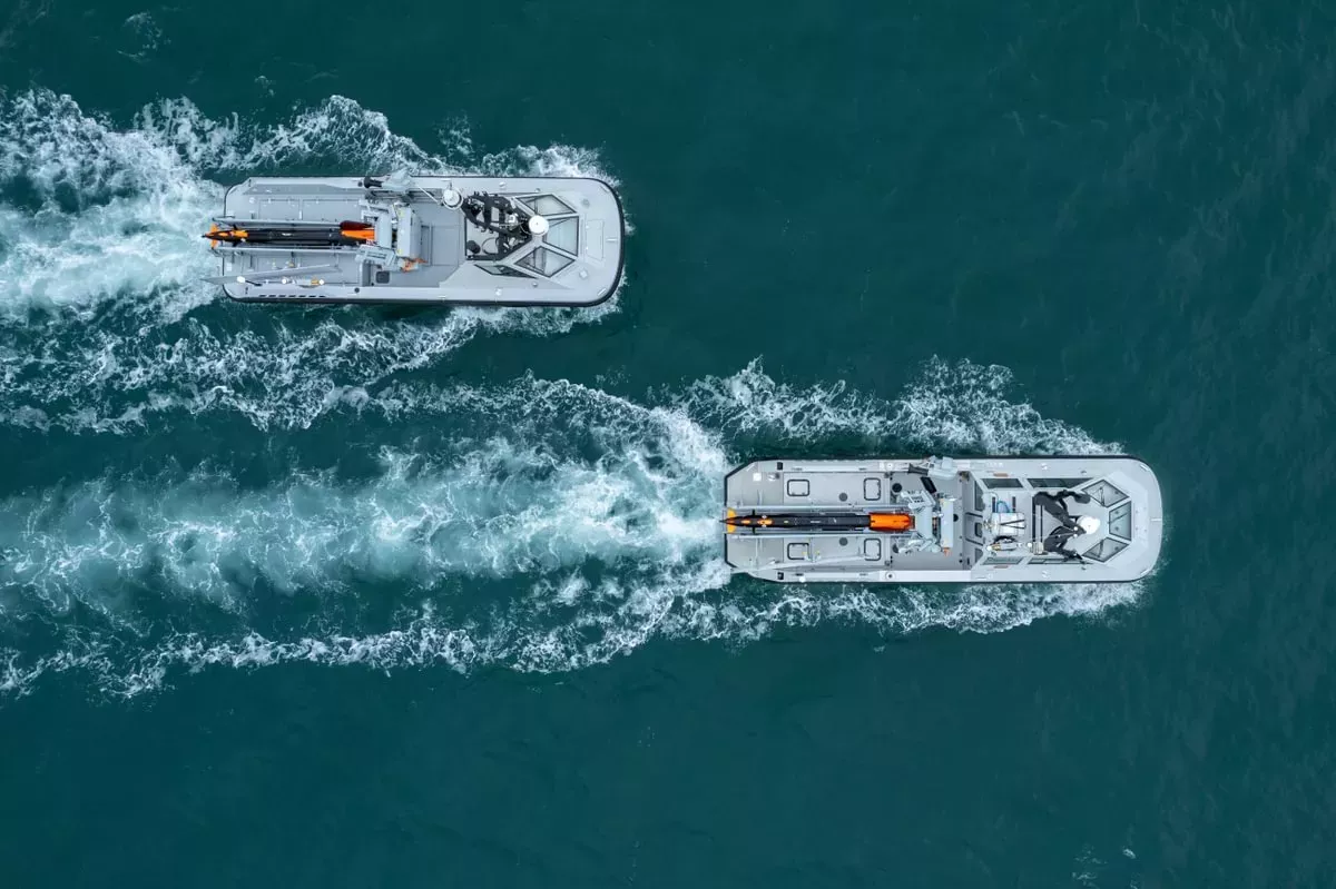
The development in technology and connectivity has fuelled the exploration into Maritime Autonomous Systems, supported by a £184 million investment by the Ministry of Defence into the joint maritime mine countermeasure programme with France. The RN is investing in the development and testing of uncrewed systems to enable this transition from traditional ship-based mine clearance to autonomous mine hunting, enabling the disposal of sea mines to be safer, more efficient and effective.
The use of uncrewed systems has significantly increased the volume and coverage of hydrographic and oceanographic data collection. Over the past 12 months, our Military Data team have witnessed a sharp increase in the volume of data being received. This is coupled with the increase in density of the information gathered by the uncrewed systems. Detailed, up-to-date seabed data, derived from route surveys of the seafloor, helps our Military Data team to identify changes such as newly laid mines or underwater explosive devices. This is especially important in areas where the seafloor is uneven with non-mine, mine-like bottom objects or in areas where the seabed alters due to natural disaster or conflict.
BodyDetailed, up-to-date seabed data, derived from route surveys of the seafloor, helps our Military Data team to identify changes such as newly laid mines or underwater explosive devices.
Working as an extension to the RN, our skilled military data experts ensure the data is processed, verified and delivered back to the RN, defence vessels and allied forces in a timely manner. Our experts maintain the high standard, reliability and usability of the information for safe navigation, situational awareness and operational planning. As the maritime data centre, the data collected is stored at the UKHO and the Military Data team maintains a close working relationship with the Mine Hunting Capability project team, ensuring that we are at the heart of ongoing discussions and developments.
Recognising the benefits of machine learning and artificial intelligence to allow efficient data processing, the team works alongside the Data Science team at the UKHO to develop Automated Target Recognition (ATR) for data processing and validation. Initially focused on mine warfare, the ATR will in time benefit wider UK defence in emerging programmes, ensuring that the best possible techniques are developed and deployed to protect our nation and prosperity on a global scale.